The 2020 DIRT Report estimated the annual societal costs of damages to buried utilities in the U.S. to be approximately
$30 billion
.
The CGA reported that
35% of utility strikes
occur from
current locating practices
in the U.S.
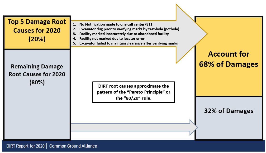
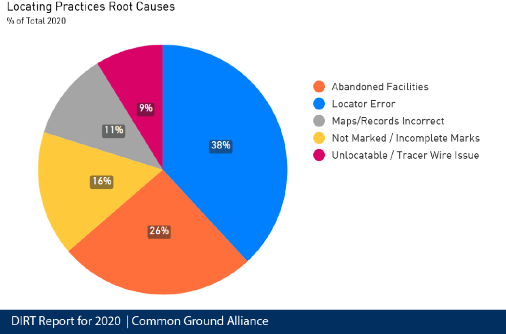
The majority of utility location companies are still using outdated methods to locate and mark utilities which can lead to utility strikes. Many underground utilities are also poorly reflected on existing drawings resulting in poor project planning.
Fortunately, Pulse Utility has the perfect solution to these problems!
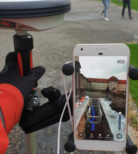
Using cutting-edge GPR technology, we can mass survey acres of land under an hour and obtain utility depth.
All of the collected survey data and as-built drawings are stored in our database for real-time use.
Using our massive database, we begin locating and marking underground utilities using sub-cm accuracy GPS augmentation.
'Visually' see your utilities underneath the ground with depth readings and much more!
(808) 238-9966
1050 Queen St, Honolulu, HI 96813
Mon – Fri ... 9am – 5pm
Sat – Sun ... Closed